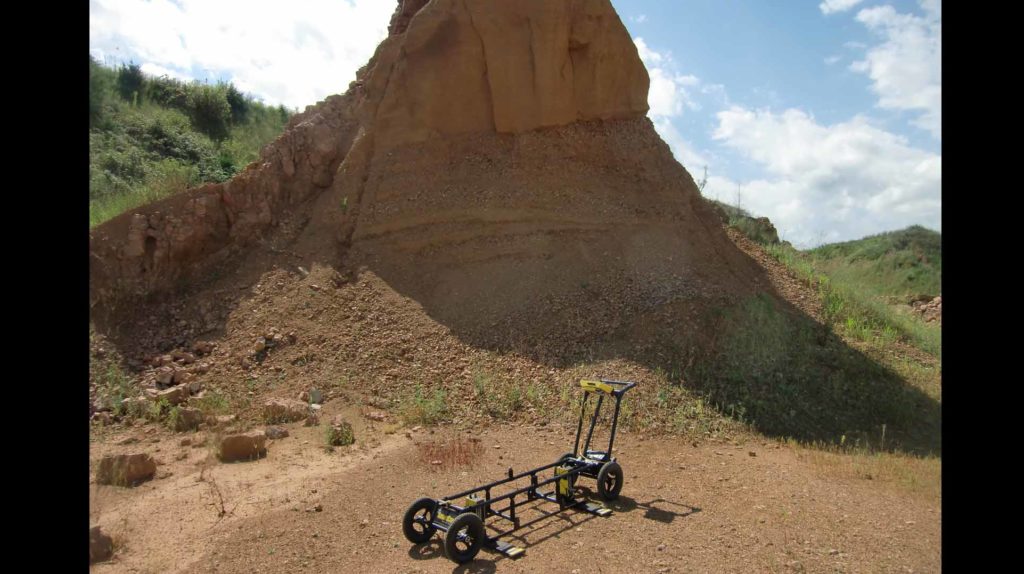
Imaging sand and gravel unit with GPR can map possible preferential paths for water to flow.

Imaging sand and gravel unit with GPR can map possible preferential paths for water to flow.
Decide which cookies you want to allow.
You can change these settings at any time. However, this can result in some functions no longer being available. For information on deleting the cookies, please consult your browser’s help function.
Learn more about the cookies we use.